Iceland Hikes: Glymur through the Years
- Zak Goldstein
- Apr 21, 2023
- 3 min read
Updated: Dec 19, 2023
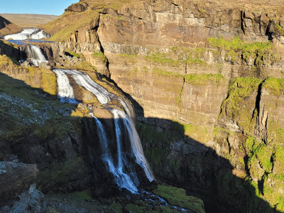
This is the perfect, must do hike for Iceland. We've done it 3 times (2016, 2021, 2022). You get to hike up the second highest waterfall in the country, with constant, beautiful views. It's a great workout, with many resting points, each with a rewarding view!
We will definitely do this a 4th and 5th time. Here are the details on the good, the bad, and the pretty insta360.

DINK Details
Pace yourself
Difficulty: Medium 1) Walk across a log over a river 2) Wade river on foot 3) Steep sections with rope to help | Time¹: 3.75 hours Distance: 4.3 mi Elv. Gain: 1,302 ft |
Condition Checks: Not Raining (mist is fine) River log is setup² | Equipment: Water shoes help (not needed) Waders if no log |
1. How long we took to walk it with breaks and all
2. There is a man made log structure that the park puts out.
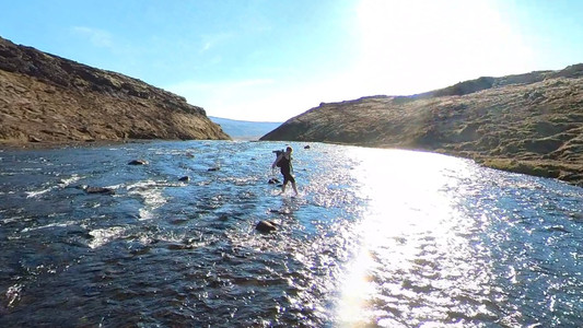
How the hell did he cross that fast? Ahhh, water shoes!!
Getting There

We only do Iceland by car, this isn't typical Europe.
The drive is one of the shortest for activities "outside of Reykjavik". There are tour groups but Glymur isn't the tour group vibe. You could get stuck with some one who doesn't know waterfalls go up and the tour guide has to deal with them instead of guiding you.
The parking is roomy but fills up during high season (June- August). Get there before 8am or after 3pm (if you are fast hikers). We personally never had issues with parking but we also don't travel during season.
Once you are settled, remember your water bottles and enjoy the the next 20 minutes of flat trail.
The Hike
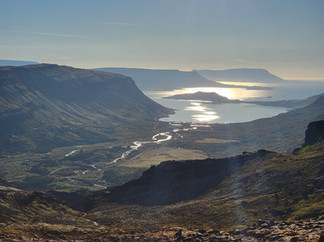
We've done this hike in Sept 2016, May 2021, and Sept 2022 (respectively to pictures below). Spring time at Glymur is not as colorful as the fall but the river crossing was easiest in May. It does change through the years....
Hvalfjörður comes into view as you gain elevation.


Obstacles
River and Log
After 20 minutes of flat hiking (the only flat part) you will reach the first crossing. The water from the foss (falls) has to go somewhere and here it is.
The log is put down in late May (we got lucky in 2021) and removed early October. Other hikers have had trouble wading across without the log so please go when its there. If you must cross without it, just know there are no "good" crossing points, the ground is uneven and waters can get waist high. Weather can change the height of glacial runoff in a matter of hours.

Rope
These sections aren't bad and the rope helps just incase.
The ropes are locked in well and easy to use.
There are about 3 sections like this. We don't like heights and this is fine.
Crossing over the Fall (river & no log)
The top of the foss has the good views but also more water. Depth can vary based on anything. We didn't make it this far in 2016 because we weren't "hiking ready". In the later 2 years, the hike was easy for us.
For the May hike in 2021, the water was low and we did it with shoes on, no problem. In September 2022, we had to wade in with bare feet and wet knees.
Shoes
VS
No shoes
Insta360! Death Stranding style!
Path Split
On the way down from the falls, you have two paths to choose from. Both Maps are available below and both have great views.
Dogs and Cliffs
If you for some reason have dogs, please be careful, we saw a dog get rescued after it jumped off a cliff. Surprisingly the dog was fine and was running back down the cliff.....
In the Area
The Settlement Center

Details
In Borgarnes (50 min from Glymur)
Restaurant and Saga museum
Nice town to explore and the museum had a lot to learn and saga is cool!
I recommend the langoustine
Link:
Maps
AllTrails (2 options)
Note: After point 2, on the way back, there is an option to head along the water fall (if its open)
Alternative (if in season): https://www.alltrails.com/trail/iceland/western/glymur


